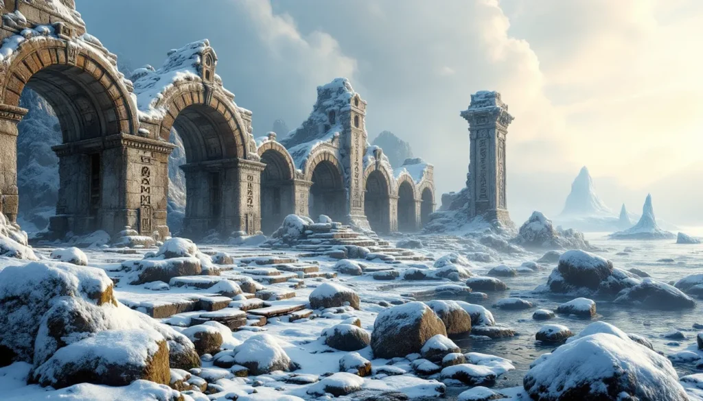
A random screenshot flashes on screen. Snow-covered mountains loom in the distance, a stone wall crumbles to the left, and pine trees dot the horizon. You’ve got seconds to pinpoint exactly where in Skyrim this image was captured. Welcome to Skyrim Geoguessr, the geography challenge that’s testing even the most dedicated Dragonborns.
What started as a niche community experiment has exploded into one of 2026’s most addictive gaming challenges. Players who thought they knew every inch of Tamriel are discovering just how much they missed during their hundreds of hours exploring. Whether you’ve completed every quest or you’re a fresh adventurer, this guide will transform you from a confused wanderer into a geography master who can identify locations faster than you can shout Fus Ro Dah.
Table of Contents
ToggleKey Takeaways
- Skyrim Geoguessr challenges players to identify locations within Skyrim’s 37 square-kilometer map using environmental clues like terrain, architecture, and flora instead of real-world geography markers.
- Each of Skyrim’s nine holds has distinct visual identities—from Whiterun’s rolling plains to Markarth’s cliffsides—that serve as the first layer of deduction in location identification.
- Skyrim Geoguessr scoring uses exponential decay to reward proximity; understanding terrain patterns, vegetation distribution, and road networks separates casual players from competitive masters.
- Common mistakes like overcommitting to single clues, ignoring compass directions, and confusing similar holds can cost thousands of points—always gather multiple confirming clues before guessing.
- The competitive Skyrim Geoguessr scene has professionalized with tournament prize pools reaching $5,000–$10,000, AI-generated challenges, and esports sponsorships emerging in 2026.
- This geography challenge proves that deep game exploration builds spatial memory worth competing over, transforming decades-old gameplay into endlessly engaging competitive entertainment.
What Is Skyrim Geoguessr and Why Is It Taking Over the Gaming Community?
Understanding the Skyrim Geoguessr Concept
Skyrim Geoguessr drops players into random locations across Tamriel with a simple mission: figure out where you are. The game presents screenshots or first-person views from various points across Skyrim’s map, and players must identify the location as precisely as possible. Points are awarded based on accuracy, with perfect identifications earning maximum scores and wild guesses tanking your rating.
The format mirrors the real-world Geoguessr phenomenon but swaps Earth’s geography for the fictional province of Skyrim. Instead of reading road signs in Cyrillic or identifying Australian architecture, you’re scanning for Dwemer ruins, recognizing the distinct stonework of Markarth, or using mountain silhouettes to triangulate your position. It’s part geography quiz, part memory test, and entirely addictive.
The challenge taps into something veteran Skyrim players already possess: spatial memory built from countless hours of exploration. That hill where you fought your first giant, the waterfall near that hidden chest, the specific arrangement of standing stones, all those mental landmarks suddenly have competitive value.
How Skyrim Geoguessr Differs from Traditional Geoguessr
While traditional Geoguessr uses Google Street View to drop players into real locations worldwide, Skyrim Geoguessr operates within a contained, fictional space. This creates a fundamentally different challenge. Earth has billions of distinct locations: Skyrim’s playable area measures roughly 37 square kilometers. The smaller space means mastery is actually achievable, you can theoretically memorize every significant location.
Skyrim lacks many of the meta-clues that experienced Geoguessr players rely on. There’s no text on signs (unless you count Dragon Language), no license plates, no Google car reflections. Instead, players must develop an entirely new skillset focused on environmental storytelling, architectural consistency, and terrain recognition. A slight change in tree density or the presence of specific mushroom types becomes as valuable as spotting a country flag in traditional Geoguessr.
The fantasy setting also removes certain advantages. You can’t phone a friend to ask about European geography or use your memories of real-world travel. Every player starts on equal footing, armed only with their experience exploring Tamriel. This democratization of knowledge has drawn in competitive players who appreciate the pure memorization challenge divorced from real-world geography knowledge.
How to Play Skyrim Geoguessr: Getting Started
Accessing Skyrim Geoguessr Platforms and Tools
Skyrim Geoguessr exists across several community-created platforms, with the most popular hosted on browser-based tools and Discord servers. The primary version runs through custom web applications built by dedicated fans who’ve screenshot-mapped Skyrim’s entire landscape. These platforms typically require no downloads, just open your browser, join a game, and start guessing.
Several Skyrim community hubs coordinate regular Geoguessr sessions, tournaments, and training events. These communities have become essential for players looking to improve, offering discussion channels where veterans share identification tips and beginners can ask about specific landmarks. The Discord integration allows for live competition, with real-time leaderboards and the satisfying feeling of watching your name climb the ranks.
For solo practice, independent web tools let you customize difficulty settings. You can filter locations by hold, limit screenshots to outdoor areas only, or challenge yourself with interior-only rounds (notoriously difficult since most buildings share similar asset pools). Some tools even integrate with interactive map overlays, letting you click your guess directly on a Skyrim map rather than typing location names.
Basic Gameplay Mechanics and Rules
Each round presents a screenshot or panoramic view from somewhere in Skyrim. Players examine the image and submit their guess for the location, typically by clicking on an interactive map or typing coordinates. The game calculates the distance between your guess and the actual location, then awards points based on accuracy. Perfect guesses within a few meters earn maximum points (usually 5,000), while completely wrong guesses might score zero.
Most formats use five-round matches, with cumulative scores determining winners. Time limits vary by platform, competitive matches often impose 60-90 second limits per round, while casual games might allow unlimited time for beginners to study details. Some variants add multiplayer elements where players see opponents’ guesses in real-time, adding psychological pressure as you watch others confidently lock in answers.
Scoring systems typically use exponential decay, meaning a guess 100 meters away scores vastly better than one 200 meters off. This rewards players who can narrow down regions even if they can’t pinpoint exact spots. Getting the hold correct but missing the specific location still earns respectable points, making the game accessible to intermediate players while maintaining a skill ceiling for geography masters.
Essential Tips and Strategies for Identifying Skyrim Locations
Recognizing Major Holds and Cities
The nine holds of Skyrim each possess distinct visual identities that become your first layer of deduction. Whiterun Hold features rolling plains dotted with farms and few trees, with the iconic Throat of the World visible to the south. Eastmarch appears more volcanic and geothermal, with hot springs and darker, more barren soil around Windhelm. The Rift showcases brilliant autumn colors with birch forests painted in gold and orange.
Cities themselves are dead giveaways if visible. Solitude sits dramatically on a natural stone arch over the Sea of Ghosts. Markarth clings to cliffsides with distinctive Dwemer-influenced stonework, if you see buildings carved directly into rock faces, you’re in the Reach. Riften features wooden architecture built over canals, while Windhelm displays dark gray stone walls and Nordic styling.
Learning the relative positions of holds creates a mental framework for elimination. If you spot the Throat of the World to your north, you’re likely in Falkreath Hold or southern Whiterun Hold. Mountains to the east with snow-capped peaks? Probably western or central Skyrim looking toward the Jerall Mountains. This geographical triangulation narrows down possibilities before you even examine detailed features.
Using Landscape Features and Terrain Clues
Skyrim’s terrain varies dramatically across regions, and terrain recognition is perhaps the most reliable identification method. The Reach features the most dramatic elevation changes, with steep mountains, deep valleys, and exposed stone everywhere. Hjaalmarch sits at sea level with extensive marshlands, fog, and minimal elevation variation, if the ground is flat and soggy, you’re likely near Morthal.
Haafingar combines coastal areas with pine forests, and the Sea of Ghosts provides clear northern orientation. Winterhold Hold presents tundra conditions, minimal vegetation, snow coverage year-round, and harsh, inhospitable landscapes. The Pale sits in Skyrim’s geographic center with moderate snow coverage and mixed terrain that can trick beginners.
Water bodies serve as excellent landmarks. The White River flows from southeast to northwest, passing near Whiterun before emptying into the Sea of Ghosts. Lake Ilinalta sits in central Falkreath Hold, while Lake Honrich defines Riften’s eastern border. Spotting these water features instantly narrows your location to specific regions, and understanding river flow directions helps orient your position.
Identifying Architecture and Building Styles Across Skyrim
Skyrim’s architectural styles reflect both functional needs and cultural preferences across holds. Nordic ruins appear throughout the province but concentrate in certain areas. Ancient Nordic tombs and barrows are ubiquitous, but their surrounding terrain indicates location, a tomb surrounded by autumn trees sits in the Rift, while one in tundra suggests Winterhold Hold.
Dwemer ruins exist primarily in three locations: the Reach (especially around Markarth), southern Winterhold Hold, and scattered sites in Eastmarch. Spotting distinctive bronze-toned Dwemer architecture immediately eliminates six holds from consideration. The same principle applies to Falmer settlements, which appear in specific cave systems and underground areas.
Farm architecture varies subtly. Whiterun Hold farms feature simpler wood construction optimized for plains environments. Riften-area farms incorporate more stone foundations and autumn-appropriate designs. Haafingar and Solitude region farms show maritime influences. These differences are subtle but become recognizable patterns after you’ve studied several dozen examples.
Leveraging Flora, Fauna, and Environmental Details
Vegetation serves as one of Skyrim’s most reliable geographical indicators, and understanding the extensive exploration you’ve done helps recognize these patterns. Birch trees with their distinctive white bark appear almost exclusively in the Rift. Pine trees dominate northern and western holds. Tundra cotton and mountain flowers appear in specific climate zones that correspond to particular holds.
Hanging moss indicates the Rift or eastern Falkreath Hold, you won’t find it in Winterhold or the Pale. Jazbay grapes grow in volcanic tundra, pointing toward Eastmarch. Canis root appears in cooler regions, while thistle prefers plains. If you’ve spent hours gathering alchemy ingredients, that knowledge translates directly into geography identification.
Fauna provides context clues too. Ice wraiths appear only in the northern tundra regions. Horkers indicate coastal areas along the Sea of Ghosts. Spriggans prefer forested areas like Falkreath Hold and the Rift. While you won’t always see animals in static screenshots, their presence in panoramic or video-based challenges offers instant regional confirmation.
Advanced Techniques for Pro-Level Skyrim Geoguessr Players
Memorizing Road Networks and Pathways
Skyrim’s road system connects all major cities and follows logical patterns that competitive players memorize. The primary central road runs from Helgen (south) through Whiterun to Solitude (northwest), with major branches connecting other holds. This main artery serves as a reference spine for the entire map.
Road surfaces and construction vary by region. Stone-paved roads appear near major cities and well-traveled routes. Dirt paths dominate rural areas but their condition indicates regional wealth, Haafingar maintains roads better than Hjaalmarch. Bridges serve as excellent landmarks since each has unique construction and crosses specific rivers or ravines at memorable locations.
High-level players memorize specific intersections and road features. That particular fork where three paths diverge? That’s south of Rorikstead. The stone bridge with the distinctive arch? That crosses into Riften from the west. This granular knowledge transforms roads from general clues into precise location markers. Several training tools available on gaming guide sites offer road network quizzes specifically designed to build this memory.
Using the Sun Position and Lighting Cues
Skyrim’s sun follows predictable east-to-west patterns, and shadows can indicate direction when combined with time-of-day information. If a screenshot shows morning light (golden, low-angle), shadows point west: evening light creates eastward shadows. This directional information helps orient mountain ranges and coastlines.
Lighting quality varies by hold due to environmental factors. Hjaalmarch often appears shrouded in fog and overcast conditions, creating flat, diffused light. The Rift shows warmer, golden tones that complement autumn foliage. Winterhold exhibits harsh, cold light with high contrast between snow and shadows. These lighting signatures become unconscious pattern recognition for experienced players.
Weather conditions correlate with geography. Ash storms occur only in southeastern regions affected by Red Mountain’s volcanic activity (though this is subtle in Skyrim compared to Solstheim). Heavy snow indicates northern holds. Frequent rain suggests Hjaalmarch or coastal Haafingar. While weather can occur anywhere, its frequency patterns provide probabilistic clues worth considering.
Spotting Unique Landmarks and Easter Eggs
Skyrim contains hundreds of unique landmarks that instantly reveal exact locations. The ritual stone, warrior stone, and other standing stones each occupy specific map positions. Dragon lairs like Shearpoint or Ancient’s Ascent feature distinctive curved walls and word wall arrangements. Giant camps with their distinctive mammoth cheese bowls appear at specific coordinates.
Many locations contain unique asset combinations that appear nowhere else. The Talos statue near Froki’s Shack, the shipwreck south of Winterhold, the hanging barrow south of Morthal, these singular locations provide instant identification if you recognize them. Competitive players maintain mental catalogs of these unique features, and many top competitors create personal reference guides with screenshots and map markers.
Quest-related locations also serve as landmarks. The Throat of the World peak, High Hrothgar, Bleak Falls Barrow, these memorable locations from major questlines are instantly recognizable. Even players who haven’t memorized every corner know these significant sites. Resources on detailed game databases catalog these unique landmarks with precise coordinates for reference.
Best Resources and Maps for Improving Your Skyrim Geography Knowledge
Interactive Maps and Reference Guides
Several comprehensive interactive maps have become essential training tools for Skyrim Geoguessr players. The UESP (Unofficial Elder Scrolls Pages) interactive map remains the gold standard, featuring toggleable layers for locations, roads, resources, and terrain. Players can click any point to see coordinates, surrounding features, and even view direction-specific screenshots from that position.
Skyrim Map HD offers ultra-high-resolution versions of the game map with enhanced detail, letting you zoom into specific areas and study terrain textures, road intersections, and landmark placement. These detailed maps help build the mental spatial model necessary for quick identification. Many players keep a reference map open on a second monitor during practice sessions, studying each round’s solution location to reinforce memory.
Printable hold maps serve old-school memory techniques. Some competitive players actually print physical maps and manually mark every location they’ve identified correctly, building a personal geography reference. This tactile approach helps certain learners better than digital tools, whatever works for your learning style deserves consideration.
Community-Created Training Tools and Quizzes
The Skyrim Geoguessr community has developed specialized training tools targeting specific skills. Hold identification quizzes present random screenshots with multiple-choice answers, building your ability to quickly categorize regions. Landmark memorization flashcards test recognition of unique features with spaced repetition algorithms optimizing retention.
Road network challenges remove all landmarks and show only paths, forcing you to recognize locations purely from route geometry. Architecture-only modes crop screenshots to show only buildings, training your eye for regional construction differences. Flora identification quizzes test your knowledge of vegetation distribution, a skill that translates directly to competitive advantage.
Several streamers and content creators offer guided virtual tours of Skyrim, walking through each hold while pointing out geographical features and identification tricks. These videos function like study guides, with experienced players narrating the exact thought process they use during competitions. Community members often share custom training maps through modding platforms on Nexus Mods, where you can download scenarios designed to test specific geographical knowledge gaps.
Popular Skyrim Geoguessr Challenges and Community Events
Speedrun Challenges and Competitive Tournaments
Competitive Skyrim Geoguessr has developed its own meta with various challenge formats. Speed challenges impose aggressive time limits, sometimes just 20-30 seconds per round, testing instant recognition rather than careful deduction. The current world record for a perfect five-round speedrun sits at an impressive 2 minutes 47 seconds, requiring both accuracy and rapid decision-making.
Perfect score tournaments remove time pressure but demand absolute precision. Players can take as long as needed, but anything less than perfect accuracy earns zero points. These competitions often come down to the wire, with winners identified by whoever completes the challenge fastest among those achieving perfection. It’s agonizing, one missed location eliminates hours of careful work.
Elimination brackets pit players against each other in head-to-head matches. Each round, the lowest scorer is eliminated until only one champion remains. This format creates dramatic moments when veterans unexpectedly stumble on tricky locations, and underdogs can advance through consistent mid-tier performance while others gamble on risky guesses.
Themed Location Challenges and Custom Maps
Dungeon-only challenges present the hardest difficulty in Skyrim Geoguessr. Interior locations lack the terrain, vegetation, and landmark clues available outdoors. Players must recognize specific room layouts, unique decorative elements, and architectural details most players never consciously noticed during regular gameplay. These challenges separate masters from amateurs.
Quest location challenges feature only sites relevant to specific questlines. An exploration of Skyrim’s content reveals hundreds of quest-specific locations that make excellent challenge material. Thieves Guild locations, Companions quest sites, Civil War battlefields, these themed challenges test both geography knowledge and questline familiarity.
Hold-specific marathons restrict all locations to a single hold. The Rift marathon, Reach marathon, and others force players to develop incredibly detailed knowledge of smaller regions. These micro-geography challenges reward players who’ve truly explored every corner rather than just learning major landmarks. They also serve as excellent training, building expertise region-by-region.
Common Mistakes to Avoid When Playing Skyrim Geoguessr
Overcommitting to single clues traps many beginners. You spot a pine tree and immediately guess northern Skyrim, ignoring the autumn foliage and stone architecture screaming “Rift.” Skyrim’s environmental features overlap more than you’d expect. Always gather multiple confirming clues before committing to a guess.
Ignoring the compass and sun position when these tools are available. Some Geoguessr variants include UI elements from screenshots, and the compass rose provides free directional information. Players focused entirely on landmarks sometimes miss this easy orientation data that could refine guesses from “somewhere in Eastmarch” to exact coordinates.
Confusing similar-looking holds accounts for the majority of intermediate player errors. The Pale and Winterhold Hold share tundra characteristics. Hjaalmarch and northern Haafingar both feature coastal marshlands. Falkreath and the Rift both have extensive forests. Learning the subtle distinctions, Falkreath’s pine forests versus the Rift’s autumn birch trees, eliminates these costly mistakes.
Neglecting interior knowledge hurts players when dungeon or building screenshots appear. Most training focuses on outdoor geography, but interiors appear in 20-30% of competitive matches. That distinctive throne room? That’s Dragonsreach in Whiterun. Those bronze pipes and steam? Dwemer ruin, likely in the Reach. Building interior recognition deserves dedicated practice.
Rushing without examining details costs points in timed modes. That extra five seconds spent checking for secondary clues, a distant mountain peak, specific flora, water body type, often transforms a 500-point guess into a 4,000-point accurate identification. Speed matters, but accuracy matters more until you’ve built enough pattern recognition for true speed.
Assuming asset uniqueness creates false confidence. Many players assume a specific building style or decorative element appears only in one location, then discover it’s a reused asset appearing in five different holds. Bethesda’s development process involved significant asset reuse, so confirmation through multiple independent clues prevents embarrassing misidentifications.
The Future of Skyrim Geoguessr and Similar Gaming Geography Challenges
Skyrim Geoguessr’s success has sparked similar projects for other open-world games. Elden Ring Geoguessr, Witcher 3 Geoguessr, and Red Dead Redemption 2 Geoguessr variants have emerged with growing communities. Each game presents unique geographical challenges, Elden Ring’s vertical level design, Witcher 3’s culturally distinct regions, RDR2’s realistic American landscapes.
The competitive scene continues professionalizing in 2026. Several esports organizations now sponsor top Skyrim Geoguessr players, and prize pools for major tournaments have reached $5,000-$10,000. Monthly league play with ranking systems and seasonal championships provides structured competition that’s attracted serious competitive players beyond casual fans.
AI-generated location challenges represent the next frontier. Machine learning models can now generate novel views from existing game geometry, creating infinite unique challenges rather than recycling screenshots from a finite pool. This technology prevents memorization from replacing actual geographical knowledge, you can’t memorize every possible viewing angle when AI generates new perspectives dynamically.
VR integration is being tested for immersive geography challenges. Instead of static screenshots, players spawn into VR environments where they can look around 360 degrees and walk a limited distance before submitting guesses. This format more closely replicates the actual exploration experience and adds new skill dimensions beyond screenshot analysis.
Cross-game geography tournaments are emerging where players rotate through multiple game universes, testing geographic memory across Skyrim, other Elder Scrolls titles, and different fantasy worlds entirely. These multi-game championships identify true geography savants who can quickly adapt spatial reasoning skills across different virtual environments.
Conclusion
Skyrim Geoguessr transforms hundreds of hours of casual exploration into competitive knowledge. What seemed like mindless wandering while clearing dungeons and collecting alchemy ingredients actually built the spatial memory and environmental awareness that now powers accurate location identification. Every dragon you fought, every sidequest you completed, every scenic detour you took, all of it contributed to the mental map you’re now testing.
The challenge reveals how differently players experience the same game. Some players remember questlines but never noticed terrain patterns. Others can identify holds instantly from architecture but struggle with road networks. Skyrim Geoguessr exposes and then fills these knowledge gaps, making you a more complete expert on Tamriel’s geography than you thought possible.
Whether you’re competing for tournament prizes or just enjoying casual rounds with friends, the game offers endless replay value from a title released over a decade ago. It’s proof that great game design creates depth that communities can mine for years, finding new ways to engage with familiar worlds. Now get out there and prove you really do know Skyrim like the back of your hand, or discover how much you still have to learn.